
MRX Learning Center
How to Build an Andrews County Mineral Rights Public-Record Locator
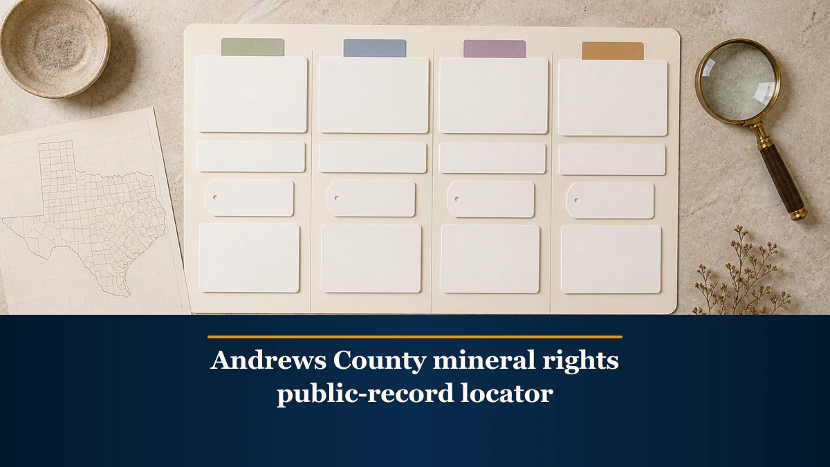
An Andrews County public-record locator preserves the exact office or system, access route, search field, displayed identifier, access date, source limitation, and next request without turning a search result into proof.
Direct answer for mineral owners
Start from the official Andrews County or agency page. Create one row per system and record the exact access route, field and value used, displayed identifier, access date, source limitation, result status, and next request. Keep county, appraisal, historical land-grant, and regulatory rows separate. The locator does not establish title, ownership, acreage, property connection, value, or a transaction conclusion.
Key takeaways for mineral owners
- Start at the official Andrews County page before following its selected records portal.
- Preserve the exact search field, displayed identifier, access date, and source limitation in every row.
- Keep County Clerk, CAD, GLO, and RRC results in separate source roles.
- Treat a blank, delayed, conflicting, or restricted result as a next-request issue, not proof.
- Stop before title, ownership, acreage, legal-effect, property-connection, value, offer, or transaction conclusions.
Administrative source-map boundary. This article organizes Andrews County record-search leads. It does not conduct a title search; validate an instrument; verify ownership; establish a chain of title, authority, acreage, boundaries, royalty decimals, payment rights, lease meaning, legal effect, or property connection; interpret production or development; estimate value; assess an offer or buyer; recommend a transaction; or provide legal, title, land, tax, accounting, appraisal, engineering, investment, or financial advice. Online systems may be delayed, incomplete, approximate, restricted, or organized under different fields. MRX provides educational information and resources only and does not buy mineral rights.
An Andrews County mineral rights public-record locator is a source map, not a findings report. It tells another reviewer where you searched, what you entered, what identifier the system displayed, when you searched, what the source says about its limits, and what request comes next.
The useful local detail is administrative. Andrews County directs users from an official county page to its selected online records portal and publishes a normal posting interval. Andrews County Appraisal District uses a separate search system with different fields and a different purpose. The Texas General Land Office preserves historical land-grant references. The Railroad Commission of Texas operates regulatory query, well-record, and map systems. These sources should never be merged into one implied ownership story.
Build the locator around eight evidence fields
Create one row for each system or record request. Preserve these fields:
- Locator row ID: a neutral internal label such as
COUNTY-REF-01. - Official office or system: the exact county, district, GLO, or RRC source name.
- Access route: the official starting page and the linked portal or query used.
- Search field and value: the exact field, spelling, punctuation, date range, and filter entered. Keep private owner data out of a shared locator.
- Displayed identifier: the instrument, property, abstract, file, API, lease, well, or other identifier exactly as shown.
- Access and source date: when you searched and any displayed posting, update, filing, or effective date.
- Source limitation: the source’s stated limit plus the unresolved scope issue.
- Result status and next request:
lead located,no result located,access restricted,conflict preserved, orneeds qualified review, followed by the next specific request.
Do not leave an unexplained blank. Write not displayed, not searched, or unknown so a later reviewer can distinguish an absent field from a completed conclusion.
Start at the Andrews County official records page
The official Andrews County Online Official Public Records Search page is the county-record starting point. It identifies the County Clerk as recorder and custodian of official public records and links the county-selected online portal. Preserve both URLs: the county page proves how you reached the interface, and the portal URL identifies the system actually searched.
The county page states that posting normally occurs within two to three business days from filing. Treat that as a normal administrative interval, not a guarantee for every instrument or a reason to assume that a recent empty search is complete. Record the search date and write normal county posting note: 2 to 3 business days from filing in the limitation field when timing could matter.
The same page sets a clear boundary: the County Clerk does not conduct title searches, determine validity, verify ownership, or give legal opinions. Copy that limitation into the locator. An index result is not a current-title conclusion, and an empty result is not proof that no instrument or interest exists.
The county portal may offer name, document, date, instrument, volume-and-page, or other interface fields at the time you search. Record only fields the live interface actually shows. Do not invent a grantor, grantee, date range, instrument type, or legal description to force a result. If a retained document lacks a usable field, mark the row needs qualified review and identify the missing reference.
Route office questions to the County Clerk
The official Andrews County Clerk page identifies real-property and land records among the office’s record classes and notes that some records may be closed by law. Use this row when the issue is administrative: which office holds the record, whether an older record is online, whether an index or image is available, or how to request an accessible copy.
Do not assume every record is digitized, open, indexed under the expected name, or contained in the same portal. Record the exact question asked, the office or channel used, the date, and the response locator. If access is restricted, write access restricted and preserve the office instruction. Do not describe restricted access as suspicious or fill the gap from another source.
The county page lists copy and certification fees, but a locator does not require a purchase. This workflow stops before ordering a paid copy. If a specific paid record later becomes necessary, its exact charge and purpose should be evaluated at that point.
Enter Andrews CAD through the official district site
The Andrews County Appraisal District site identifies the district’s appraisal role and links its official property-search destination. Preserve the district page as the access route, then record the actual search interface separately as Andrews CAD Property Search.
At the time of review, the search interface displayed fields such as owner, street number and name, abstract, Property ID, property type, Owner ID, Geographic ID, tax year, subdivision, and related filters. Record the exact field used. If a source document supplies an abstract but no property ID, do not silently switch fields and call the returned record a match. Preserve each attempt in its own row.
The property-search interface describes its information as a research resource and warns that legal descriptions and acreage are maintained for appraisal use and should be verified before legal use. That limitation is central to the locator. A property card can be an administrative lead, but it does not prove mineral title, present ownership, a severance or reservation, net mineral acres, a royalty decimal, or the legal sufficiency of a description.
An appraisal amount is also not an MRX mineral-sale value, offer benchmark, or market conclusion. Keep any displayed value out of this locator unless it is necessary to identify the source record; even then, label it appraisal-system display only; no mineral-sale inference.
Keep historical land-grant fields separate
The Texas General Land Office Land Grant Search provides historical search fields including county, abstract, original grantee, patentee, class, file number, certificate, patent dates, patent number and volume, part or section, survey, block, and township.
Use the narrowest field already supported by a retained record. Copy the displayed GLO identifier and search field exactly. A land-grant result is a historical archive locator. It does not establish the current chain of title, identify every later conveyance, reservation, probate event, or severance, or prove that a private document describes the same interest.
When several results appear plausible, keep each identifier and mark conflict preserved. Do not choose the result that merely shares a surname or looks geographically close. State the additional document, survey evidence, or qualified land or legal review needed to distinguish them.
Split RRC work into query, well-record, and GIS rows
The Railroad Commission Research Queries page is a directory to regulatory systems. Create a row for the exact system chosen, not one generic RRC searched row. Preserve the query name, field, date, and result identifier. The Commission describes online datasets as informational and continually updated rather than authoritative records with legal force.
The Commission’s Oil and Gas Well Records page explains which details help locate a file. It identifies the county, the approximate drilling date, the lease or well name and number, the operator, the field or reservoir, the Commission identifiers, and the location reference. A source may express the location reference as a survey, an abstract, a section, or a block. Record only details already supported by the source file. A well record does not establish who owns minerals, who should be paid, or whether the well is connected to the owner’s tract.
Keep the RRC Public GIS Viewer in its own map row. Preserve the layer, search field, popup identifier, access date, and the Commission’s limitation that map data may be approximate, is informational, and has no legal force. A map point or apparent proximity is not a legal boundary, survey, tract match, well-to-interest connection, development conclusion, or value input.
Keep the four source roles from bleeding together
| Source role | Preserve | Do not infer |
|---|---|---|
| County Clerk and portal | official route, field, displayed instrument reference, search date, posting note | validity, current title, ownership, legal effect |
| Andrews CAD | official route, field, displayed property identifier, tax year, research limitation | mineral title, acreage for legal use, mineral-sale value |
| Texas GLO | historical search field and land-grant identifier | present ownership, tract coverage, current chain of title |
| Texas RRC | exact query, regulatory identifier, record or popup locator, access date | private property connection, payment rights, production entitlement, value |
If two systems display similar text, preserve both rows and use a neutral cross-reference such as POSSIBLE-SAME-REFERENCE-01. Do not merge the identifiers. A later professional conclusion should remain a separate evidence object with its own author, date, scope, and supporting records.
Handle empty, delayed, conflicting, and restricted results
An administrative locator is most useful when it preserves failure states accurately.
- No result located: save the source, field, exact spelling, filters, date range, access date, and screenshot or stable locator if permitted. Do not write
no record exists. - Posting delay possible: preserve the county’s normal posting note and the filing date if the source shows one. Do not predict when a particular record will appear.
- Conflict preserved: keep each system’s identifier and describe the difference without selecting a winner.
- Access restricted: identify the office instruction and next lawful request. Do not attempt to bypass access controls.
- Needs qualified review: state the unresolved question without suggesting the answer, such as
Which complete instruments are needed to evaluate this index lead?
The next request should be narrow. Examples include asking the clerk which index covers a stated date range, asking the appraisal district which field generated a displayed property ID, requesting a specific RRC well file by a source-provided identifier, or asking a qualified reviewer to compare complete records. Avoid open-ended requests to confirm my minerals because that turns an administrative search into an unsupported conclusion.
Use a blank, privacy-conscious template
Copy these labels into a spreadsheet or document. Keep owner names, tax IDs, account numbers, addresses, and private instrument details out of a broadly shared version.
- Locator row ID:
__________ - Official office or system:
__________ - Official starting page:
__________ - Portal or query used:
__________ - Search field and redacted value:
__________ - Displayed identifier:
__________ - Search and source dates:
__________ - Posting, update, or access note:
__________ - Source-stated limitation:
__________ - Result status:
__________ - Conflict or unknown:
__________ - Next record request and owner:
__________
Use a neutral placeholder such as COUNTY-REF-01 in examples. Do not publish a real owner’s search history merely because the underlying portal is public.
Final quality-control checklist
The locator is ready for the next reviewer when:- every row starts from an official county, district, GLO, or RRC route;
- the portal, query, field, spelling, filters, and access date are reproducible;
- identifiers are copied exactly and remain source-specific;
- the county posting note and each source limitation are preserved where relevant;
- no blank, delayed, restricted, or conflicting result is converted into proof;
- CAD information remains appraisal-purpose evidence rather than mineral-title or mineral-value evidence;
- GLO information remains historical and RRC information remains regulatory;
- no GIS result is described as a boundary, survey, tract match, or well-to-interest connection;
- private owner data is redacted from shared examples; and
- the locator makes no title, ownership, acreage, legal-effect, production, development, value, offer, buyer, or transaction conclusion.
A strong Andrews County public-record locator is intentionally limited. It preserves the county-specific administrative path and makes the next request traceable. That discipline helps an owner avoid repeating searches while keeping owner-specific conclusions with complete evidence and the appropriate qualified professionals.
Frequently asked questions
Does the Andrews County online records portal perform a title search?
No. The county states that the clerk does not conduct title searches, determine validity, verify ownership, or provide legal opinions. Preserve an index result as a source-linked lead and use complete records and qualified review for owner-specific conclusions.
Does a blank portal result mean no document or mineral interest exists?
No. Preserve the exact search field, spelling, filters, access date, and the county posting note. A record may be delayed, indexed differently, restricted, offline, outside the selected range, or held by another office.
Can an Andrews CAD record prove mineral ownership or mineral-sale value?
No. Appraisal records serve an appraisal and tax-administration role. The search also warns that displayed legal descriptions and acreage should be verified before legal use. Do not convert a CAD record or appraised amount into title, ownership, market value, or offer evidence.
Does a GLO or RRC identifier connect a well or land grant to my tract?
No. Keep each identifier in its own historical or regulatory source row. A property connection requires separate matching evidence and, when appropriate, qualified land, title, legal, or technical review.
Does this locator estimate Andrews County mineral-rights value?
No. It does not analyze production, geology, development, royalties, comparable sales, offers, buyers, or valuation methods. It only makes official public-record research reproducible and source-limited.
Sources reviewed for this article
- Andrews County, Online Official Public Records Search (accessed 2026-08-23)
- Andrews County, County Clerk (accessed 2026-08-23)
- Andrews County Appraisal District (accessed 2026-08-23)
- Andrews CAD Property Search (accessed 2026-08-23)
- Texas General Land Office, Land Grant Search (accessed 2026-08-23)
- Railroad Commission of Texas, Research Queries (accessed 2026-08-23)
- Railroad Commission of Texas, Public GIS Viewer (accessed 2026-08-23)
- Railroad Commission of Texas, Oil and Gas Well Records (accessed 2026-08-23)
Related mineral-rights articles
How to Build a Robertson County Mineral Rights Public-Record Locator
A Robertson County public-record locator keeps county, land-grant, and oil-and-gas search leads source-linked without treating them as title or value proof.
Read the post →
Texas Railroad Commission: Public Records for Mineral Rights
Use RRC records to research production, leases, operators, and permits. Investigate title separately through county instruments and qualified review.
Read the post →
How to Build a Property-Scope Crosswalk Before Comparing Mineral Rights Offers
A property-scope crosswalk puts the tract and interest descriptions from separate mineral-rights documents side by side before anyone compares price or terms.
Read the post →
How to Build a Mineral Rights Sale Document Package Index
A mineral-rights sale document package index reconciles every source file, page, exhibit, schedule, addendum, signature copy, and replacement without interpreting the documents.
Read the post →A practical next step
Put your mineral rights in context.
Every mineral interest, royalty history, and written offer is different. Start with a question, or share what you have for a free underwriter review.
- Free
- Confidential
- No obligation to sell
Ready for a closer look?
Request an Underwriter ReviewGet a directional range with the assumptions clearly stated.
