
MRX Learning Center
Pecos CAD Oil and Gas Property Discovery: RRCID, Permit, and January 1
The Pecos plan describes an RRCID-to-permit discovery sequence and three January 1 tests, but those statements do not establish a current property result.
Direct answer for mineral owners
Pecos CAD’s plan says mineral properties are identified using an RRCID, while production before that identifier may be reported by drilling permit number. It then lists three January 1 tests and a records sequence for location, situs, and interests. These are plan statements, not proof about a current property.
Key takeaways for mineral owners
- The controlled plan PDF is 971,223 bytes with SHA-256 c95d84641a0d024c04b9d8ba491e5972085b29a05a9aba4038128d78e8e12d01.
- Physical page 42 preserves the plan’s RRCID and drilling permit number wording without defining those labels as equivalent.
- The plan prints three separate January 1 conditions: reported production, completion shown by a report, or perforation into a producing formation showing oil or gas.
- Completion reports and plats support the plan’s location-to-situs sequence; DOI statements have a separate interest role.
- Later reviews and up-to-five-year supplementation are process statements, not proof that a named property was added or changed.
Official-plan process locator, not a current property finding. This article records what physical pages 42-43 of Pecos County Appraisal District’s 2025-2026 Reappraisal Plan say about oil-and-gas property discovery. It does not establish a named well’s status, whether production occurred before a date, whether a completion report was filed, situs, ownership, title, an interest decimal, an appraisal, a tax amount, private value, an offer, or a transaction result. MRX provides educational information and resources only and does not buy mineral rights.
The direct answer is: the Pecos plan describes a sequence, not a current-property result. Physical page 42 says mineral properties are identified and appraised based on an RRCID. It says production may be reported by Drilling Permit Number (DP) when a well starts producing before an RRCID has been issued. The same page then prints three conditions tied to January 1.
Keep those labels, steps, and source statements separate. Do not silently replace RRCID with API number, lease ID, gas ID, or drilling permit number. Do not apply a plan condition to a particular property without the current official records for that exact question.
Direct answer: the source-preserving sequence
| Sequence point | What the Pecos plan says | What the statement does not prove |
|---|---|---|
| Identifier | Mineral properties are identified and appraised based on an RRCID. | What RRCID expands to or which current RRC field equals it. |
| Pre-identifier production | Production before an RRCID may be reported by drilling permit number. | That one named well used a permit number or had production. |
| January 1 screen | Beginning-of-year searches look for new wells that started producing before January 1. | That a current search was run or a property passed the screen. |
| Location and situs | Completion reports and plats support location; jurisdictional maps support situs work. | Current situs, account assignment, ownership, or title. |
| Interest input | DOI statements are requested for working and royalty interests. | A current decimal, pay status, division order, or ownership conclusion. |
| Later review | Later database reviews may identify wells added after the first of the year. | That a particular well was found, added, or supplemented. |
The official Pecos CAD Data and Records page links the 2025-2026 Reappraisal Plan PDF. The statements below come from that controlled plan, not from a live property search.
Bind the exact source before using the procedure
The controlled PDF retrieved for this review is 971,223 bytes with SHA-256 c95d84641a0d024c04b9d8ba491e5972085b29a05a9aba4038128d78e8e12d01. It has 75 physical pages, is unencrypted, and contains no embedded JavaScript. Its metadata records creation on August 8, 2024 and modification on September 2, 2024.
Physical page 42 begins the relevant section under the printed heading Property Discover and Data Collection Process. The source uses “Discover,” not “Discovery.” This article preserves that heading as an observed publisher string while using ordinary grammar in the article title.
The file controls make the citation reproducible. They do not prove the plan was implemented, that its terminology matches every current RRC field, or that a condition applies to one property.
Preserve the identifier terminology instead of normalizing it
Physical page 42 uses Railroad Commission Identification Number (RRCID) and Drilling Permit Number (DP). It does not state on that page that RRCID is an API number, oil lease number, gas ID, or drilling permit number.
The Texas RRC Well Records - Online page currently describes searches and record packets using labels such as API number, oil lease number, gas ID number, W-1 drilling permit, G-1 gas completion packet, and W-2 oil completion packet. The RRC downloadable-data page separately says production on a pending lease may use API or drilling permit identifying information before an official lease ID is assigned.
Those RRC pages corroborate that multiple identifiers and record types exist. They do not supply a one-line definition proving which current field the Pecos plan means by RRCID. The controlled rule is therefore:
- quote RRCID when reporting the Pecos plan;
- quote the RRC page’s own API, lease, gas ID, permit, and form labels when reporting that page; and
- leave the mapping unresolved unless an official source defines the exact relationship for the exact context.
That unresolved terminology boundary prevents a plausible but unsupported identifier substitution.
The three January 1 conditions are separate
Physical page 42 says a well is considered to have value as of January 1 if one of three conditions is present:
- it reported production before January 1;
- it filed a completion report showing completion before January 1; or
- it was perforated into a producing formation that showed the presence of oil or gas before January 1.
These are three source statements joined by “or.” Do not collapse them into one “production date” test. Do not convert them into a legal conclusion, a current appraisal rule, or proof that a named well had value. This article does not inspect a live production record, completion packet, perforation record, appraisal account, or tax roll.
The distinction matters because the plan itself describes different evidence paths. A completion-report date is not silently substituted for a production date, and a perforation statement is not silently treated as either one.
Location, situs, and interests occupy different steps
The next two procedure items on physical page 42 assign distinct roles:
- Completion reports and plats: the plan says they are retrieved from the RRC to identify producing-well locations.
- Jurisdictional maps: the plan says locations are cross-referenced with these maps to establish situs.
- Division of Interest statements: the plan says these are requested from the operator to establish working and royalty interests.
A process sequence is not a result. A completion report or plat does not by itself prove current appraisal situs. A DOI statement is not a title opinion, recorded conveyance, current division order, pay-deck confirmation, or final ownership determination. The plan’s assigned roles should not be merged.
For statewide instructions on retrieving a permit query, use the separate Texas RRC Drilling-Permit Query Retrieval Provenance Worksheet. That page owns the query-retrieval job. This Pecos page owns only the appraisal plan’s discovery sequence.
Physical page 43 adds later review and supplementation
Procedure item 4 continues onto physical page 43. The plan says additional RRC database reviews occur during the year to identify wells that may have entered the database after the first of the year but were completed before January 1 of the appraisal year. It then says new producing wells identified after the appraisal period are supplemented, going back up to five years.
Preserve all qualifiers:
- the statement is a plan procedure;
- “may have been added” describes a search rationale;
- the completion timing remains before January 1 of the appraisal year;
- “going back up to five years” modifies the printed supplementation statement; and
- no named well, account, supplement date, appraisal change, notice, or result appears in this article.
Physical page 43 also says other subject-property data may come from regulatory reports, the Texas Comptroller, and the property owner; some submitted data may require confidentiality. It says data are verified through existing records and published reports and notes that no standard data-collection form or manual exists because of the unique nature of many oil-and-gas properties. Those are source statements, not permission to disclose confidential data or infer that a particular confidential record exists.
A bounded owner verification worksheet
If the plan sequence matters to a current property question, keep a source log with separate rows:
- Plan route and bytes: record the official URL, retrieval time, byte size, SHA-256, page count, encryption status, and JavaScript status.
- Exact plan term: record RRCID without expanding it unless the controlling source does so.
- Current RRC identifiers: record the exact API, lease, gas ID, drilling permit, or form label displayed by the current RRC source.
- January 1 condition: record which of the three plan statements is being investigated; do not substitute another condition.
- Location evidence: keep the completion report and plat distinct from the jurisdictional map and situs conclusion.
- Interest evidence: keep a DOI statement distinct from recorded title, a division order, and current payment records.
- Later review evidence: record whether a later search or supplement is actually documented; do not infer one from the plan.
- Current account evidence: retrieve the applicable Pecos CAD account, notice, or roll record for any present appraisal or tax question.
- Transaction evidence: use separate property, title, lease, production, risk, market, buyer, and agreement evidence for a private value or offer question.
What this process does not answer
| Unsupported conclusion | Separate evidence still required |
|---|---|
| A named well produced before January 1 | Current RRC production evidence with exact identifiers and reporting period. |
| A completion report proves current completion status | The official packet, amendments, dates, identifier reconciliation, and current status evidence. |
| A map cross-check proves ownership or title | Current appraisal records plus recorded instruments and qualified title review. |
| A DOI statement proves the final decimal | The exact statement, effective date, operator records, title support, and current payment evidence. |
| A property was supplemented within five years | A dated supplement or appraisal-change record tied to the exact property. |
| The plan determines a private sale value | Property, title, lease, production, engineering, risk, market, buyer, and transaction evidence. |
For the same plan’s separate parcel-estimate job, use Pecos CAD 2025-2026 Reappraisal Plan: Category G Parcel Counts by ISD. That page owns physical page 37. This article owns physical pages 42-43.
Evidence claim ledger and source status
| Claim ID | Evidence label | Controlled observation | Boundary |
|---|---|---|---|
| C288-01 | ROUTING-ONLY | Pecos CAD’s Data and Records page links the 2025-2026 Reappraisal Plan. | A link does not prove implementation, current status, or a property result. |
| C288-02 | VERIFIED-OBSERVATION | The PDF is 971,223 bytes, SHA-256 c95d84...12d01, unencrypted, without JavaScript, and 75 pages. | File controls bind retrieved bytes; they do not validate a plan statement. |
| C288-03 | SOURCE-STATEMENT | Physical page 42 uses RRCID and says pre-RRCID production may be reported by drilling permit number. | The source labels are preserved without expansion or equivalence. |
| C288-04 | SOURCE-STATEMENT | Physical page 42 prints three separate January 1 conditions. | No condition is applied to a named well, property, account, appraisal, or value. |
| C288-05 | UNRESOLVED-CONFLICT | The Pecos plan’s RRCID wording does not directly map itself to current RRC API, lease, gas ID, or permit labels. | No identifier substitution is made without an official definition for the exact context. |
| C288-06 | SOURCE-STATEMENT | Completion reports, plats, jurisdictional maps, and DOI statements occupy distinct plan steps. | A process input is not proof of situs, ownership, title, an interest decimal, or current status. |
| C288-07 | SOURCE-STATEMENT | Physical pages 42-43 describe later database reviews and supplementation going back up to five years. | No particular search, addition, supplement, date, or result is claimed. |
| C288-08 | CORROBORATING-SOURCE | The RRC well-record page identifies W-1, G-1, W-2, plat, lease, gas ID, and API record labels. | Record-type corroboration does not prove Pecos CAD used one record. |
| C288-09 | CORROBORATING-SOURCE | The RRC data page describes API or permit information for pending-lease production before an official lease ID. | That wording does not define RRCID or prove a property-specific result. |
| C288-10 | NON-VALIDATING | No live account, notice, title instrument, DOI statement, permit file, completion packet, appraisal, tax bill, value file, offer, or transaction was treated as proven. | Current and property-specific status requires separate official evidence. |
Retrieval, originality, and creative evidence
The rejected value-guide identity is not published. The replacement title and slug were absent before implementation. The nearest current canonical title is Crane CAD Oil and Gas Reappraisal Plan Source Locator at token-Jaccard 0.25. That article owns a different county and a general plan-locator job. The generic RRC permit worksheet owns retrieval instructions. Article 287 owns Pecos physical page 37. This article uniquely owns the Pecos plan’s physical-pages-42-43 discovery sequence and terminology boundary.
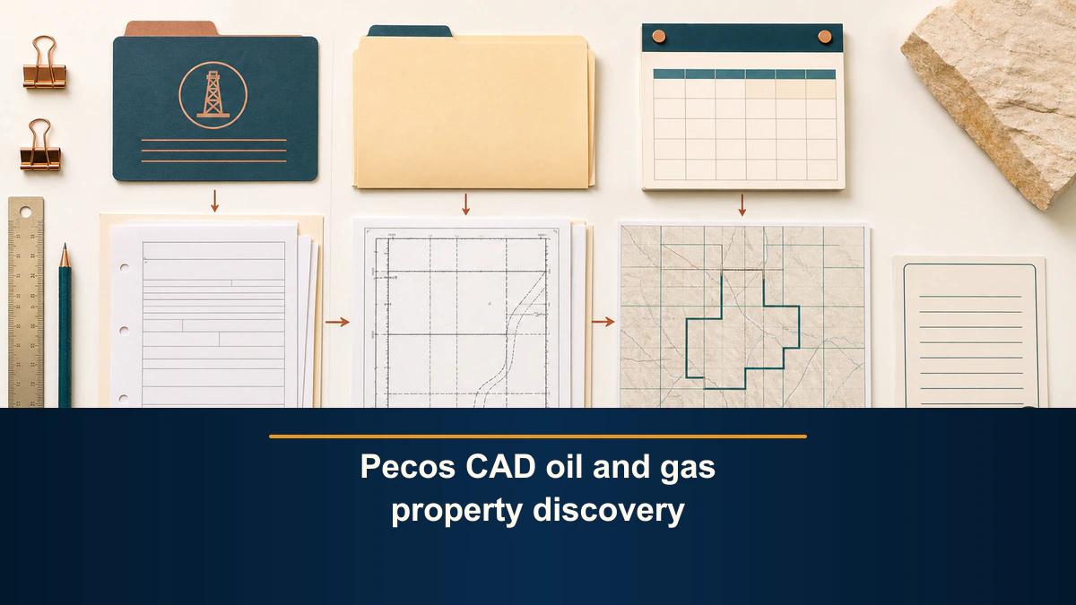
Physical pages 42 and 43 were text-extracted and visually checked. The dark low-oblique hero and bright strict-overhead inline composition were independently generated. Deterministic typography adds the exact canonical title to the hero and the exact primary keyword to the inline image. The two source images and public WebPs are distinct binaries.
Sources reviewed for this article
- Pecos CAD Data and Records page
- Pecos CAD 2025-2026 Reappraisal Plan
- Texas RRC Well Records - Online
- Texas RRC Data Sets Available for Download
If the process matters to a current property, use the current official records for the exact identifier, date, record type, account, and question rather than the plan as the final authority.
Frequently asked questions
Where does the Pecos CAD plan describe oil and gas property discovery?
Physical pages 42 and 43 contain the section titled Property Discover and Data Collection Process and its four-step procedure.
Does the plan say an RRCID and a drilling permit number are the same?
No. It uses the labels for different points in its description. This article preserves that wording and does not infer one-to-one equivalence.
What are the three January 1 conditions printed on physical page 42?
The plan lists reported production before January 1, a completion report showing completion before January 1, or perforation into a producing formation that showed oil or gas before January 1.
Do completion reports, plats, and DOI statements prove current ownership?
No. The plan assigns them process roles for location, situs work, and working or royalty interests. Current ownership and title require separate evidence.
Does the up-to-five-year statement prove a property was supplemented?
No. Physical page 43 describes a supplementation process. It does not identify a particular property, action, date, or result.
Sources reviewed for this article
Related mineral-rights articles
Pecos CAD 2025-2026 Reappraisal Plan: Category G Parcel Counts by ISD
The plan prints separate Category G parcel estimates for 2025 Buena Vista ISD and 2026 Fort Stockton ISD, not a county total or owner-level result.
Read the post →
Crane CAD Oil and Gas Reappraisal Plan Source Locator
Preserve the current Crane CAD plan identity, oil-and-gas section locators, source relationship, retrieval provenance, and document-control state.
Read the post →
Texas RRC Drilling-Permit Query Retrieval Provenance Worksheet
A drilling-permit query provenance worksheet preserves the exact official route, criteria, displayed result fields, source limits, retained reference, and bounded retrieval status without interpreting a permit.
Read the post →
Texas RRC Imaged Potential File Retrieval Provenance Worksheet
Use a potential-file retrieval provenance worksheet to preserve one manual RRC Imaged Records route, criteria reference, source state, evidence, and bounded outcome.
Read the post →A practical next step
Put your mineral rights in context.
Every mineral interest, royalty history, and written offer is different. Start with a question, or share what you have for a free underwriter review.
- Free
- Confidential
- No obligation to sell
Ready for a closer look?
Open the Texas Mineral Rights GuideGet a directional range with the assumptions clearly stated.
